The Hidden Vale Nature Refuge (formerly known as Old Hiddenvale) was established in January 2007. It comprises 3,091 hectares of a 4,500 hectare working cattle station.
The Nature Refuge is located in the Little Liverpool Range (part of the Great Dividing Range) between Franklin Vale Creek and Mulgowie Valley. The range borders the local government areas of Ipswich City Council and Lockyer Valley Regional Council, with Western Creek flowing through its centre.
The land is mostly covered with open eucalypt forest and is largely mountainous, with basalt benches with black soil creek flats. Its vegetation has been identified as a regionally significant corridor which connects to the Little Liverpool Range and extends to Main Range National Park.
The Nature Refuge provides suitable habitat for rare and threatened species including the Glossy Black-Cockatoo, the Square-tailed Kite, and a healthy population of Koalas.
The area is protected in perpetuity through a Conservation Agreement between The Turner Family and the Queensland Government. This agreement binds any future owners, and those with an interest in the land, to conserve the area’s significant natural and cultural resources and provide for the controlled use of the land’s natural resources for livestock production, eco-tourism and adventure activities.
Traditional Owners
Centuries before European explorers carved routes west, north and south of the young Moreton Bay penal settlement, the Yuggera Ugarapul people inhabited the region roughly from Ipswich to Maroon and westward to the Dividing Range. Nomadic like their neighbouring cousins, the Githabul people to the south and the Wakka to the west, the Yuggera Ugarapul were a distinct social unit “owning their homeland and governing themselves”.


Spicers Peak Nature Refuge
Spicers Peak Nature Refuge was established in 2006 and comprises 2,000 hectares of a 3,000 hectare property which also includes a working cattle station. It shares a seven kilometre boundary with Main Range National Park. This has meant that this area of significant conservation value is protected in perpetuity through a Conservation Agreement. The agreement binds all future owners and those with an interest in the land to conserve the area’s significant natural and cultural resources, and provide for the controlled use of the land’s natural resources for livestock production, eco-tourism and adventure activities.
Mount Mistake / Thornton View
At the base of the Main Range lies Thornton View and an adjoining property called Mount Mistake. These properties were acquired in 2003 to form a 682-hectare area with diverse ecosystems and wildlife including the endangered Brush-tailed Rock-wallaby, Glossy Black-Cockatoo and Koalas.
The Thornton View property has a 354-hectare Nature Refuge to protect the habitat in perpetuity. The property marks the start of the Scenic Rim Trail, a five-day guided walk through the properties and into Main Range National Park.
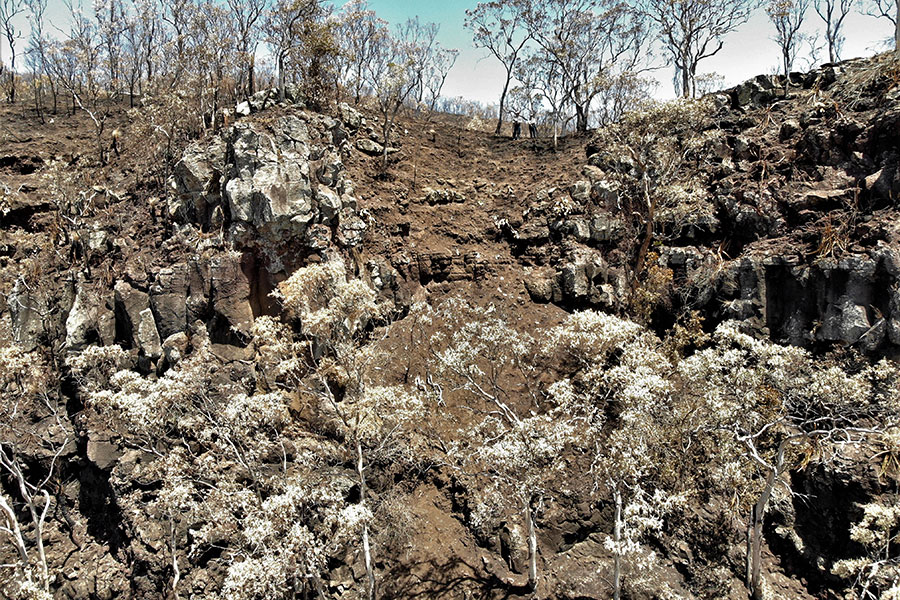
This area was badly impacted by bushfire and is slowly regenerating.